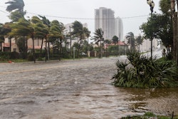
Over-the-road shipping of high-value goods can be a hazardous process. Bad weather, traffic jams, route detours, mechanical failures, driver negligence and improper loading and poor storage procedures can jeopardize product quality and delay delivery schedules.
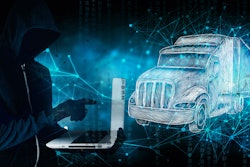
But for shipping routes that cross paths with high-crime areas, the potential for product and/or truck theft — as well as risks to drivers’ personal safety (i.e., kidnapping or truck-jacking) — raises the stakes for all involved. In the United States, exporters that ship goods into Mexico are experiencing these issues firsthand.
To protect against product loss and/or degradation — and the worst-case scenario of truck theft and/or driver injury — many companies are investing in real-time location tracking and geofencing technologies that can help provide much-needed insurance policies.
Geofence technology overview and security considerations
A geofence is a virtual perimeter established around a designated geographic area using the global system for mobile communication to create a boundary (aka fence) around a specific region — in this case, a high-risk zone. To create the geofence, location tracking devices equipped with SIM cards that connect to cellular networks are placed on a truck’s shipping trailer or refrigerated container. Each device has a unique identifier that can be loaded into cloud-based software and tracked in near real time.
The software establishes the boundaries of a geofence based on specific coordinates, which can then be monitored on a live interactive map. When a shipping truck enters or exits a virtual boundary around a physical location, the software can be configured to issue alerts to designated stakeholders to put them on notice of potential danger. Even if a geofence is not set up, these tracking devices and software can be used to monitor the real-time locations and conditions of in-transit shipments.
Today’s sophisticated criminal networks may use jamming devices to prevent visibility to real-time locations. But with this tracking and geofencing infrastructure in place, the loss of a signal alone is a reason for concern and an indication of a potential threat. Fortunately, software and/or device reporting intervals can be shortened to increase the communication frequency with cell towers to enable real-time location positioning, thereby increasing the possibility of locating and recovering their load.
Typical real-world scenario
Shipping cotton across the U.S. border from Texas to Mexico is one likely scenario in which theft may occur. For example, in the clothing manufacturing supply chain, cotton is a very high-value commodity where full truckload values could range from $50,000 to $100,000.
Just south of the Texas-Mexico border is a crime zone with a high probability of theft. Typically, cotton exporters in this region experience several incidents per year. Without the live tracking tools and geofencing capabilities to raise awareness of shipments passing through this danger zone, companies may literally place their profits and carrier safety in harm’s way.
One best practice for shippers in this region is to change their tracking device’s reporting interval to every minute, activating an “emergency situation” monitoring configuration — increasing the potential for communication with cell towers. This way, stakeholders can receive live location updates and/or immediately be notified immediately when truck doors are left open. They can view the coordinates of the last known location of the shipment and share this information with the appropriate authorities to accelerate a resolution. In addition, if the light sensor detects unauthorized access to the shipping container, stakeholders are notified immediately with the specific time and location of the occurrence.
Once an active geofence has been established around a danger zone, stakeholders can receive proximity alerts and/or notifications when shipments enter and exit the area. Integrating these alerts into quality control (QC) efforts gives teams real-time notice when their shipment has a greater potential for theft.
Begin your theft prevention program
By implementing these real-time tracking devices into shipping programs and establishing geofences around high-risk zones, global supply chain stakeholders can address a spectrum of security and safety challenges. The combination of cloud-based cargo software and expert supply chain services gives stakeholders the tools they need to improve shipment security, protect profits, settle disputes, and maximize product quality.