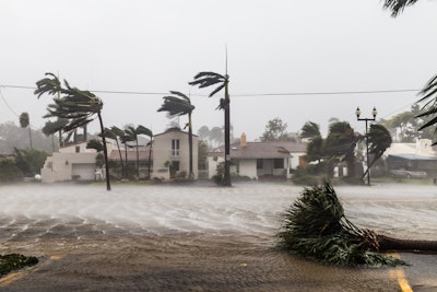
Families, businesses and officials in Bermuda are being urged to prepare for storm surge, powerful winds and flooding rainfall as Hurricane Ernesto makes a close encounter with the islands this weekend, according to AccuWeather experts.
Although Hurricane Ernesto will remain hundreds of miles away from the U.S. Atlantic coastline, the storm is creating rough surf and dangerous rip currents that could impact beaches from Florida to Maine. Families, businesses and officials in Atlantic Canada need to be prepared for impacts to arrive late this weekend after Ernesto blasts Bermuda.
“Bermuda has already received a lot of rain from the frontal boundary that stalled over the past few days. A dip in the jet stream is pulling Ernesto toward Bermuda. We’re forecasting the hurricane to brush by Bermuda as it’s losing wind intensity,” says AccuWeather chief on-air meteorologist Bernie Rayno. “Bermuda is going to be in the right front quadrant of this storm; that’s the worst side of a hurricane to be on. The center of circulation will be off to the west of the islands. We expect high impacts from wind, rainfall and storm surge in parts of Bermuda.”
Key takeaways:
- AccuWeather expert meteorologists are forecasting 4-8 inches of rainfall from Hurricane Ernesto, with an AccuWeather Local StormMax of 13 inches. Strong wind gusts of 100-120 mph are expected in Bermuda on Saturday, with an AccuWeather Local StormMax of 140 mph. Families and businesses along the southern, western and eastern coasts of Bermuda should be prepared for 3-6 feet of storm surge.
- Powerful winds and drenching rainfall from Ernesto caused flooding and widespread power outages across Puerto Rico and parts of the Virgin Islands.
- Parts of Newfoundland could get 2-4 inches of rainfall from Ernesto with an AccuWeather Local StormMax of 8 inches. Close 60- to 80-mph wind gusts are expected in parts of Newfoundland, with an AccuWeather Local StormMax of 100 mph.
“Everyone in Bermuda needs to be prepared for impacts from Ernesto,” says Porter. “We have a team of more than 100 expert meteorologists at AccuWeather. Once again, we were the first source to highlight the risk for this tropical threat to become a hurricane. We issued our first track forecast for this storm 24 hours before the National Hurricane Center and other sources.”
"At this time, we believe Ernesto will be taking a north-northeast path as it approaches Atlantic Canada early next week, and that brings up the possibility of a landfall in Newfoundland," says AccuWeather lead hurricane expert Alex DaSilva.


