In a world where the population is growing at alarming rates and the climate is changing faster than we can adapt to it, making sure everyone has enough to eat is a big challenge. It’s time to think about how we grow and distribute food in new ways. It’s not just about the weather getting out of control — it’s about making sure today’s food system can handle all kinds of pressures.
Food security isn’t just about having food on the shelves either. It’s about ensuring that everyone everywhere can get enough healthy and safe food. It also means that the people who grow and produce food can make a decent living. A big part of this is having a strong food system that works from the ground up, which implies smart, data-driven farming practices, smart distribution, and fair access for all.
Many modern technologies can help with these tasks. One of them is free satellite imagery and its analysis. Satellites can watch over fields from space, giving farmers a detailed look at their crops. They can see where plants are thirsty, where pests might be attacking, and even predict bad weather. Having access to free satellite imagery of a chosen area of interest, farmers can extract information necessary to make better decisions and generate more produce while using fewer resources.
Main threats to food security
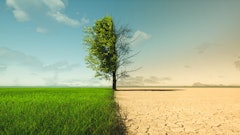
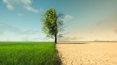
Climate change poses a significant threat to food security. Erratic weather patterns, fluctuating temperatures, rising sea levels, and changing landscapes disrupt the natural balance, leaving plants, trees, and wildlife struggling to adapt. Agriculture, heavily dependent on stable environmental conditions, suffers greatly. When humidity prevents plants from flowering, pests thrive in warmer temperatures, super typhoons decimate crops, and cold weather freezes vegetables, the consequences are dire.
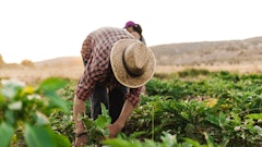
Adding to this challenge is the aging farming population. With many farmers retiring and few young people willing to take their place, the future of farming is uncertain. Younger generations are deterred by the lack of capital, access to land, and the lure of more lucrative careers. Climate change only adds to their hesitation, presenting new and unpredictable challenges for aspiring farmers.
Another huge factor often overlooked is the decline in bee populations. It may seem minor, yet bees are crucial for pollinating many food crops, and now they are dying off due to reckless pesticide use. While other insects might fill the pollination gap, the loss of bees is a significant blow. Its impact on food production is quite notable, and the preventable nature of this loss is particularly tragic.
Soil erosion further compounds these problems. Over the past 150 years, half of the planet’s topsoil has been lost due to deforestation and poor agricultural practices like overgrazing and pesticide use. This erosion pollutes waterways, destroys aquatic life, and necessitates the use of chemical fertilizers, which harm soil biodiversity and contaminate food.
Conflict is another critical factor driving the global food crisis with more than 60% of those who experience hunger living in conflict zones. Wars and conflicts force people to abandon their homes and farms, disrupting livelihoods, long-term agricultural strategies, and supply chains, making it sometimes completely impossible for people to simply access food.
The role of satellite data in ensuring food security
Access to free satellite images and their on-the-fly analytics has revolutionized the way we approach food security by providing a comprehensive view of agricultural conditions across the globe. By using data from satellites, experts can monitor crop health, detect early signs of stress, and respond to potential threats to food production. This technology captures detailed information on vegetation health, drought conditions, soil moisture, and precipitation levels. It enables precise analysis of plant health risks and supports the development of strategies to prevent food instability and famine.
Integrating free up-to-date satellite images with artificial intelligence and machine learning models has further enhanced its capabilities. These advanced technologies offer permanent solutions to pressing issues in the global food crisis, helping agricultural specialists and policymakers make informed decisions. Real-time monitoring tools, powered by satellite and ground data, allow for efficient farm management even amidst changing weather conditions and fluctuating food demands.
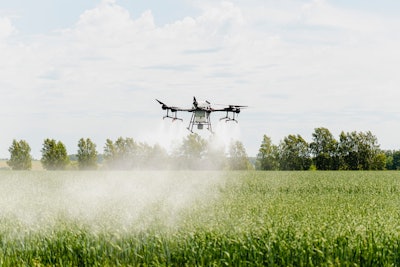
Collaboration with other cutting-edge technologies, such as drone systems, ground sensors, GIS layers, predictive and prescriptive analytics, and more, has expanded the potential of satellite data. It has unlocked the possibilities of hyper-local evaluations, crop health threats prediction, weather tracking, and growth changes detection. Such insights are of gold for understanding biomass levels and ensuring robust food production.
One significant advantage is the availability of most up-to-date satellite imagery for free, which helps to ensure that changes in food production are based on accurate, data-driven insights. By leveraging remote sensing technologies, we can monitor and estimate food production, managing crises before they occur. For instance, satellite images help analyze soil fertility, moisture, and chemical composition, manage water supply and support sustainable development goals in developing countries.
Moreover, satellite data facilitates real-time mapping and tracking of irrigated land, creating simulations and timelines to visualize crop growth progress. It guides fertilizer application, ensuring that all plants are protected from diseases and pests. This data also helps with predicting crop yields and comparing them with food demand for the purpose of analyzing country's food security rates. Additionally, satellites predict weather changes and natural phenomena like landslides, droughts, and wildfires that impact crops.
In essence, satellite technology acts as a vigilant guardian of our food production system, providing critical insights to maintain crop health, sustain food production, and prevent crises, ensuring a stable food supply for the future.


